If you’re not from the Midwest, what do you know about the area? Would you like to know more? If you live there—particularly in southern Indiana—are you curious about surrounding counties?
I am a native southern Hoosier, yet I readily admit to ignorance of much of my home state. I’m slowly fixing that and I’m starting in the lower left corner of the state map, Posey County.
This is the first of several installments I intend to write as I learn more about the toe of Indiana, or, if you’re facing west, our leading edge.
The Game Begins
“Good things come to those who wait.”
I question that as an unqualified truth. My car’s dashboard report read, “ENGINE OIL CHANGE ALMOST DUE”. That was a fib, if not an outright lie. I knew full well I was 2,000 miles beyond the suggested change date. Waiting any longer seemed imprudent.
We no longer have a business in my hometown that will do oil changes on demand. Thus, a day of wandering with my wife began by moving among Indiana counties.
In northern Indiana, most of the counties look like a great Architect told his or her helper to hold one end taut as they snapped a chalkline. County borders are mostly right angles. Not squares, but sharply defined shapes, like a haphazard chess board. So, with my Queen beside me, let the game begin.
Move 1: Daviess to Knox
In the lower southern counties of Indiana, the shapes begin to look as if the helper wandered off at a critical moment and the string went slack. Or perhaps as if the counties are being crushed by the burden of the great wall of counties they are supporting.
We’re rather proud of that burden. We know it’s our coal, our timber, our rivers, and the beauty of our counties that are contributing greatly to the success of our state.
Clearly, these irregular borders—though set by man—were determined with Nature in mind. Waterways divide counties and even states, going where they will despite the inconvenience to surveyors.
With our engine successfully lubricated and our tires fully inflated, we were free to wander once more. But with purpose. A Posey purpose.
Move 2: Knox to Gibson
Moving south down Highway 41, we drove through Gibson county to Interstate 64, taking the interstate west toward St. Louis. More on this county and its points of interest in a future post.
Move 3: Gibson to Posey
We exited I-64 at Frontage Road in Poseyville, which despite its promising name is not the county seat of this sprawling county. Did I say “exited”? I should probably have said “excited”, because there, beside the interchange, was a large metal building surrounded by attractive planting beds and sufficient parking for a horde of people. It was the Red Wagon restaurant.
 |
| Red Wagon Sign (Picture from theredwagonrestaurant.com) |
Wagon Ho!
 |
| The Red Wagon Restaurant & Bar (picture from theredwagonrestaurant.com) |
I’d heard of this establishment from a prospective client and was eager to try it. Inside we found artwork proudly depicting local businesses and landmarks, country-themed crafts and gifts, and thick wooden tables with solid wooden chairs made to withstand the wear and tear of generations of patrons. A widely varied menu caused us some consternation. We knew we’d only be able to try one meal at this sitting. Ah, well. It’s good to have a place where we’d like to spend much more time.
Dear in the Headlights
It’s nice to be seated and be addressed as “Dear.” I did a mental double-take at first, but it wasn’t affected. It was simply that person’s sense of hospitality, setting us at ease, letting us know we were welcome, and that we would be taken care of like family. Possibly better, depending upon your family.
Having tended to our hunger, we continued south. I said we were wandering, but I don’t mean to infer we had no purpose. In Mt. Vernon, they were celebrating River Days. But first we had to get there.
Destinations
There are three major towns in Posey County: Poseyville, New Harmony, and Mt. Vernon. It seems unfair to focus on those three, because in a county that encompasses 410 square miles, a person will not see it all in one day. But, loosely, those were our destinations. We look forward to returning to Poseyville and seeing more than The Red Wagon.
From our location, Mt. Vernon was another 30-minute drive. If you just want to be someplace, 30 minutes is an inconvenience. When the landscape is attractive, the time and distance are no matter.
Subtlety in Color
As we drove, I wondered how the scenery between Poseyville and Mt. Vernon would appear to a casual visitor. They might say, “It’s all green.” True-ish. It was mostly greens. Bright greens, light greens, and fading greens brightly lit by sunshine and standing in contrast to a beautiful blue sky. No promise it’s always this way, but it was an excellent day to be enjoying the views.
I think it’s important to appreciate this color palette because the roads we traveled went through agricultural land. I can imagine the greens giving way to browns later in the season and through the winter, then rich browns developing a greenish cast as seeds germinate and thrust through the soil to drink in sunlight and rain. From there, the cycle would repeat itself as it has since man has decided turning over the earth here and planting seeds is a good idea. And that notion goes back to the Hopewell Native American culture who lived in the area 500-200 BCE.
Knowing you’ll experience these colors, let me tell you where we saw them.
Corn. Tall tasseled stalks were green from the ground up the stalk, with brown leaves where moisture and chlorophyll had receded. Just an indication of the approaching harvest, when the stalks will be more completely brown and nature will have done a significant part of the drying process.
Soybeans. We saw large swaths of beans--verdant, leafy plants with vivid yellow crowns. They were completing their stationary march through the season.
Hay. Large, round bales dotted a field, punctuation marks on the landscape. A twisted tapestry of yellow, brown, and green that would continue to fade until one winter day when it became a welcome offering to livestock in a snow-covered pasture.
So much to see on these curving roads. And we weren’t even near Mt. Vernon, yet. But we were getting close.
Mt. Vernon
As we came into town from the north, the first thing we saw was the bright, white cupola of the courthouse. Soon, we saw its red brick walls as well. As in so many population centers, this symbol of law and justice is prominently displayed among other important Government offices and is not only impressive, but attractive with many old and newer architectural flourishes.
 |
| Posey County Courthouse, Mt. Vernon, Indiana |
What is that smell? Do you ever get a whiff of something and you just turn until the aroma gets stronger? I did. It led me toward the river, but that was not the source. No, River Days was the scene of a flurry of activity interspersed with a lot of patience. The flip side of goodness coming to those who wait. Smoking was definitely permitted. Seemingly everywhere. Small rigs and large setups lined the streets. You knew people had awakened very early to prepare the meats they were entering in a smoked meat competition. Oh, my goodness. If we hadn’t come directly from the Red Wagon, I’d have been out some serious coin sampling what I was smelling. Other vendors had trailers and booths, purveying sweet beverages, fried delicacies, public awareness, hand-made crafts, clothing, and even an infant changing station. (The latter was not for trade-in, just normal maintenance)
We enjoyed a show by Indiana WILD (https://www.facebook.com/Indiana-WILD-124745117580115/), and petted our first Fennec Fox and a Ball Python. We admired the Riverfront park, the bike trail, and the new, expanded sidewalks along Main Street. I even ogled a motorcycle or two.
 |
| Indiana WILD and John, a young man who knows an astonishing amount about animals. |
We wished we had more time, but there were a couple of stops we still wanted to make. One of our greatest desires was to walk in the shade.
Harmonie & (New) Harmony?
Seventeen miles north of Mt. Vernon, just a couple of miles from State Road 69, is Harmonie State Park. After paying the $7 entrance fee and talking with a gregarious ranger about the park amenities, we drove around the large loop that provides access to many ways visitors can experience the outdoors. Harmonie has a swimming pool during the summer, rental cabins, campsites with electricity, areas for tent camping, hiking and biking trails, a nature center, and a boat ramp that lets into the Wabash River.
If you expect the lowlands around rivers to be completely flat, rethink. As we drove the loop, the wooded areas to either side can best be described as wrinkled. Deeply wrinkled on a scale that can provide challenging hikes or bike rides, if that's your wish. For those less adventurous, there are also plenty of flatter stretches where you can exercise at a more moderate pace. The walk along the Wabash from the boat ramp to the playground was particularly pretty. On the Illinois side, a family had pitched a large dining tent on the sandbar and played alongside the water.
 |
| Weathered stump. |
 |
| These trees were probably victims of our spring rains and flooding. Upstream is evidence of further submerged snags. Despite these possible dangers to boaters, what a beautiful day! |
From Harmonie, we went four miles further north along Maple Hill Road to New Harmony. Along our route as we entered town, people were carefully tending their properties, contributing to the sense of neatness and civic pride that pervades the town. We arrived too late in the day to enjoy shopping, but we did walk around a public garden area and enjoy a dinner at Sara’s Harmony Way.
 |
| Thankful somebody took the time to patiently train the vines embracing this garden seat and arbor. |
 |
| Russet foreshadowing crunches underfoot around this space for reflection. |
 |
| The rare and beautiful New Harmony Tree Fairy capturing a memory. |
At Sara's, we elected to sit on the patio. Its ridged spherical black bubbler fountain, large fire pit, and comfortable seating has a welcoming funky vibe. Enamel metal eating utensils and tableware hang from beaded strings, softly clinking and clanking in the breeze. A chunky, weathered, red fire hydrant showing yellow patches stands near a metal trellis strung with fairy lights.
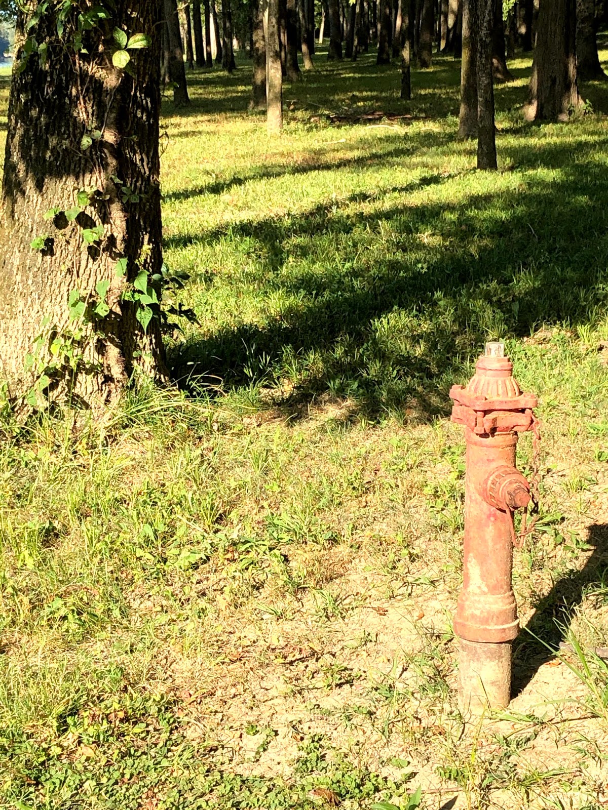 |
| This hydrant at the Harmonie State Park boat ramp seems reduced in stature. |
 |
| But this one at Sara's Harmony Way is more robust, if not nearly so effective when called upon. |
Because you never know when you might need a hydrant. Water provided separately. The patio was an excellent use of the space and adds to the air of congeniality of the establishment.
Finally, it was time to turn the car toward home.
Moves 4-8:
4. Posey to Gibson
5. Gibson to Vanderburg
6. Vanderburg to Gibson
7. Gibson to Pike
8. Pike to Daviess
Game over. For now.
This was a much needed date day away. Now we look forward to learning more about Posey County and its attractions. Next time with friends.
If you have a special place in Posey County we should visit, let me know!
No comments:
Post a Comment